| Time: | June 26, 2023, 4:00 p.m. – 6:00 p.m. |
|---|---|
| Download as iCal: |
|
We are very honoured to welcome Andreas Wieser, Full Professor at the Department of Civil, Environmental and Geomatics Engineering at the ETH Zürich, in our upcoming Constructive Conversations event on Monday, 26 June 2023 from 4:00-6:00 p.m.
Andreas Wieser will give a lecture on Capturing and Processing Point Clouds: From 3D Geometry to Surface Properties.
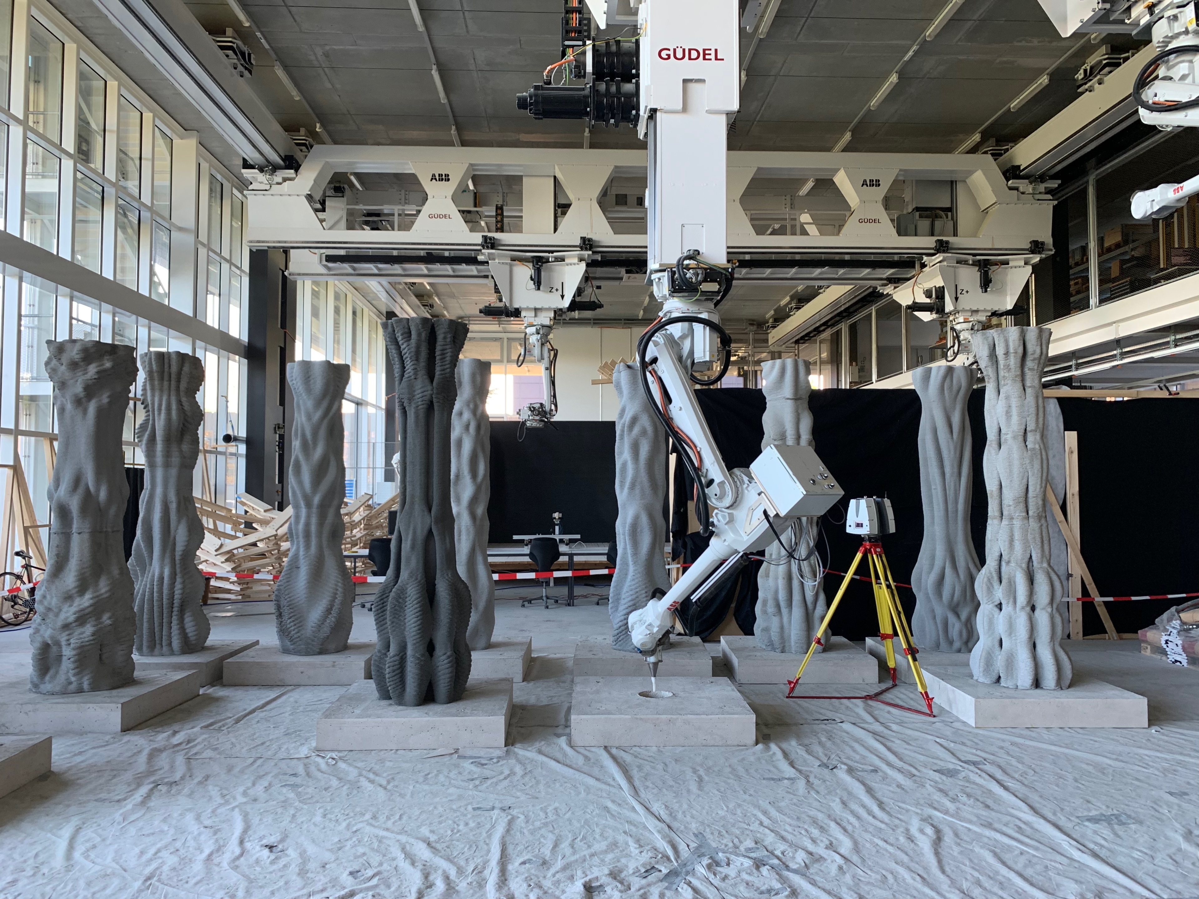
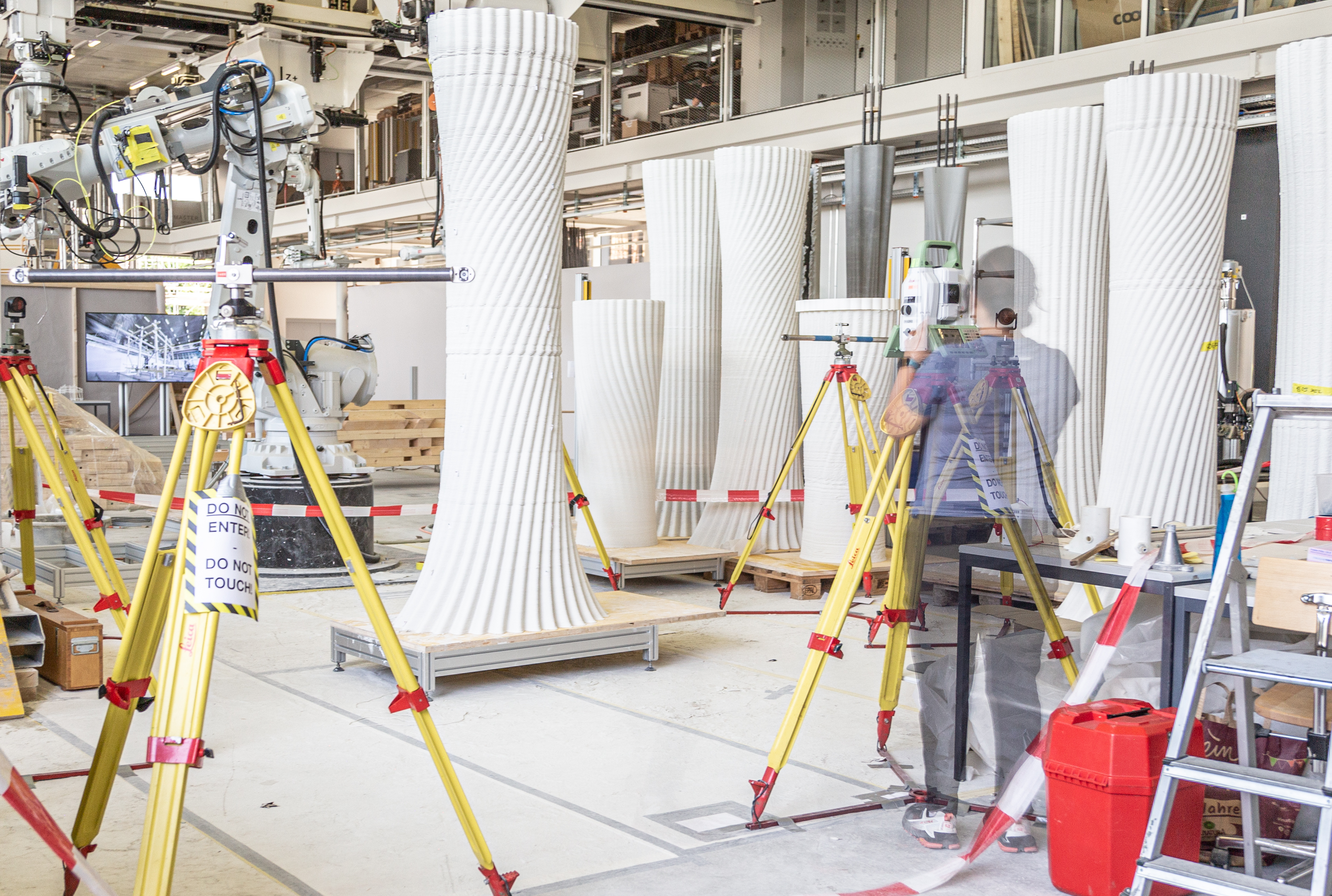
Image: Post-fabrication scanning of 3D concrete printed columns using a terrestrial laser scanner in ETH Zurich’s Robotic Fabrication Laboratory
The event will take place both in person and digitally.
| Title: | Capturing and Processing Point Clouds: From 3D Geometry to Surface Properties |
| Speaker: |
Andreas Wieser |
| Date: | 26 June 2023 | 4:00-6:00 p.m. |
| Location: | Room 01.008 (M11.11) | K1, Keplerstr. 11, University of Stuttgart |
| Webex-Link: |
This lecture is part of the AdvanceAEC partner seminar series. Please register or log in to access the event credentials. |
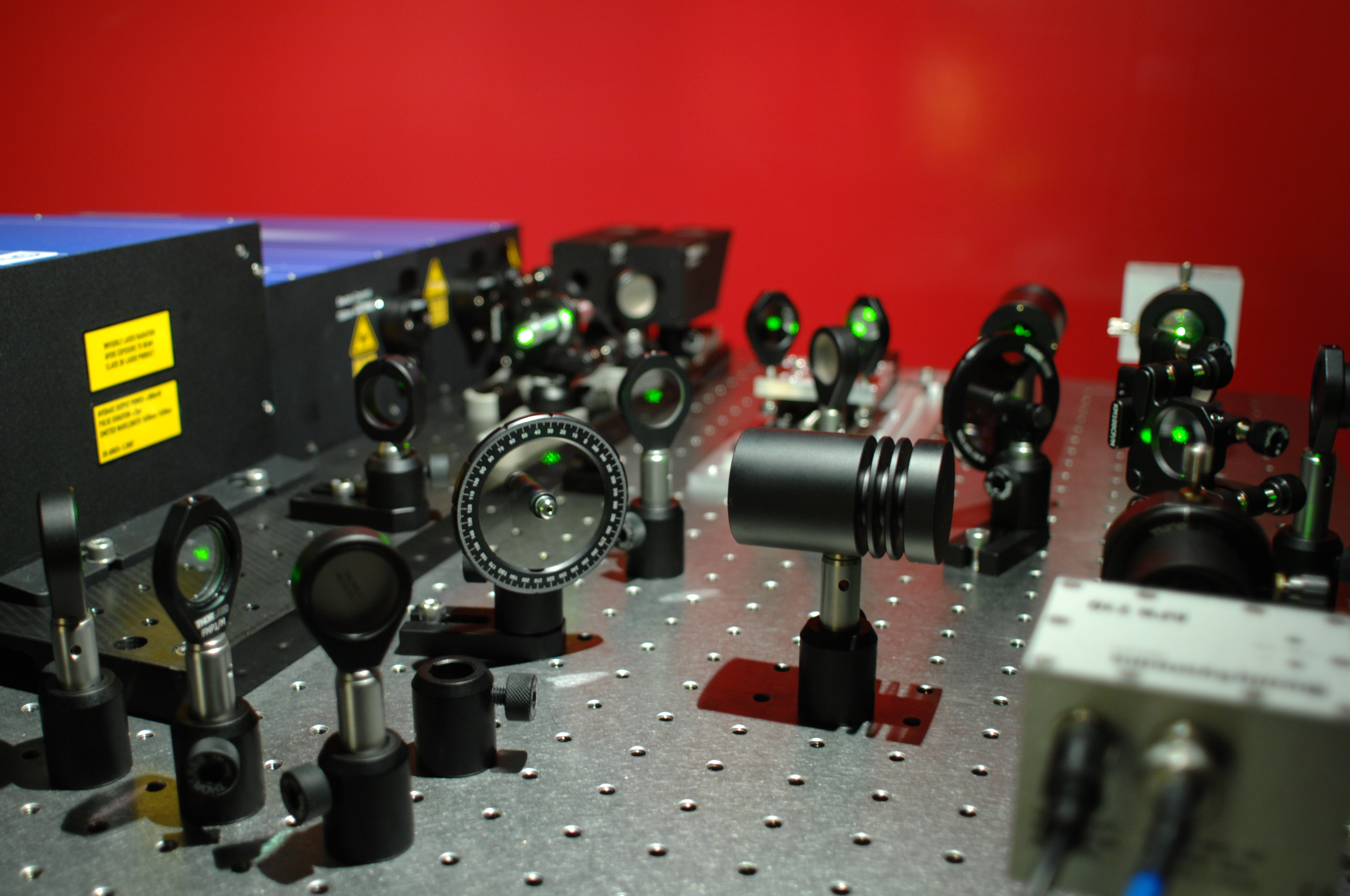
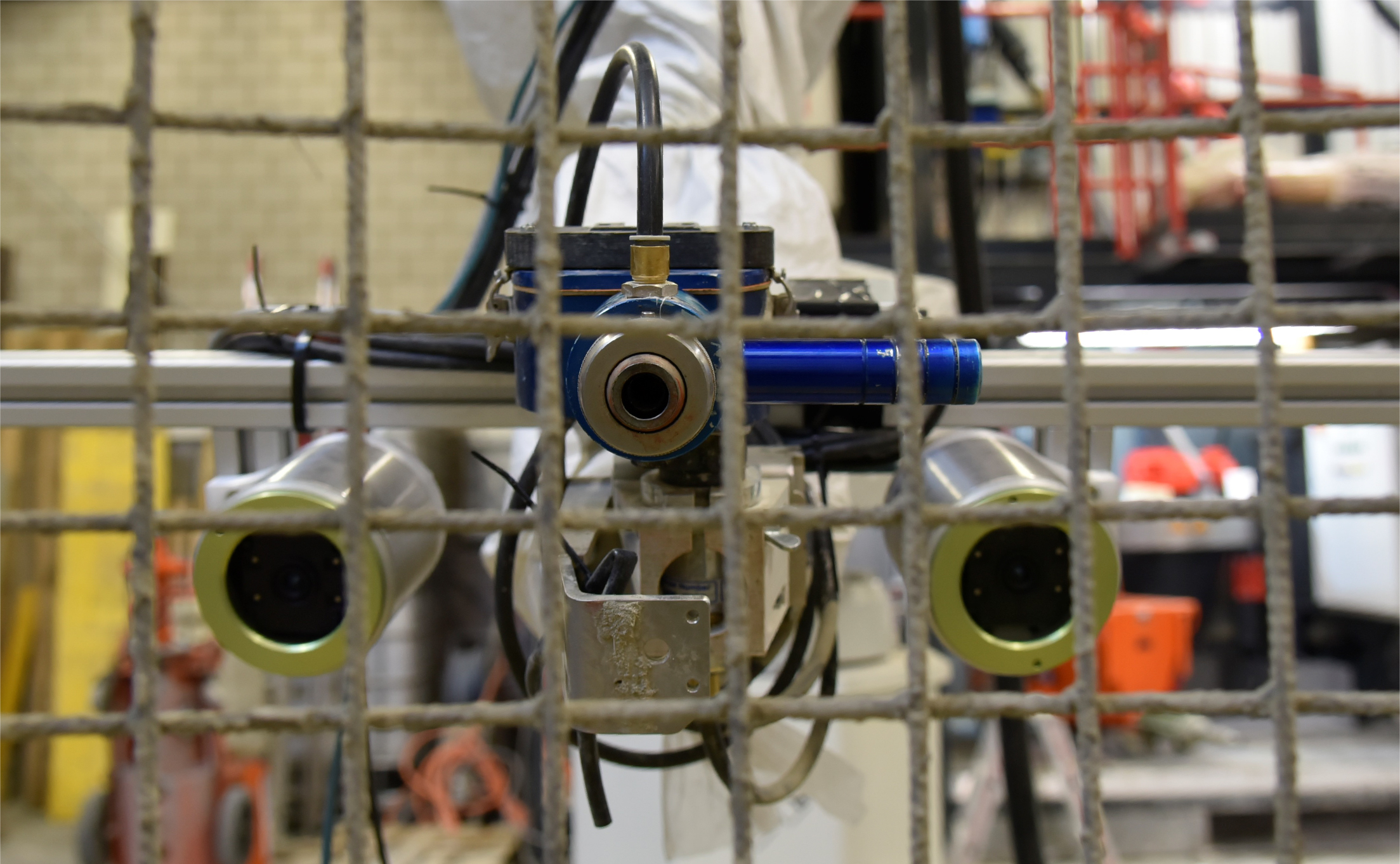
Image: Experimental frequency comb laser unit for multispectral multimodal LiDAR
Lecture Abstract
Breathtaking developments of sensors and highly-automated data processing pipelines have transformed point cloud technologies from tools for 3D mapping specialists to commodities for a wide range of applications and for use by almost anyone. Capturing 3D reality now seems simple. And in many cases, it is – especially when the goal is a plausible digital representation of the surfaces of a real-world scene. But when the data is needed to control a construction process, to assess conformance, status or changes of a structure, to be interpreted semantically, or to be accurate to the mm or sub-mm level, significant challenges arise. They relate to the instruments, the environment, the measurement processes and the data processing.
In this presentation, I will give an overview of these challenges and the research that helps to overcome them. I will focus on terrestrial laser scanning and on aspects relevant for deformation monitoring, for the comparison of planned and executed surfaces, and for extracting information beyond geometry, e.g. material, roughness and humidity. I will cover approaches that can be applied using commercial off-the-shelf instruments, and I will present the status and potential benefits of a multispectral multimodal LiDAR system developed by my own research group.
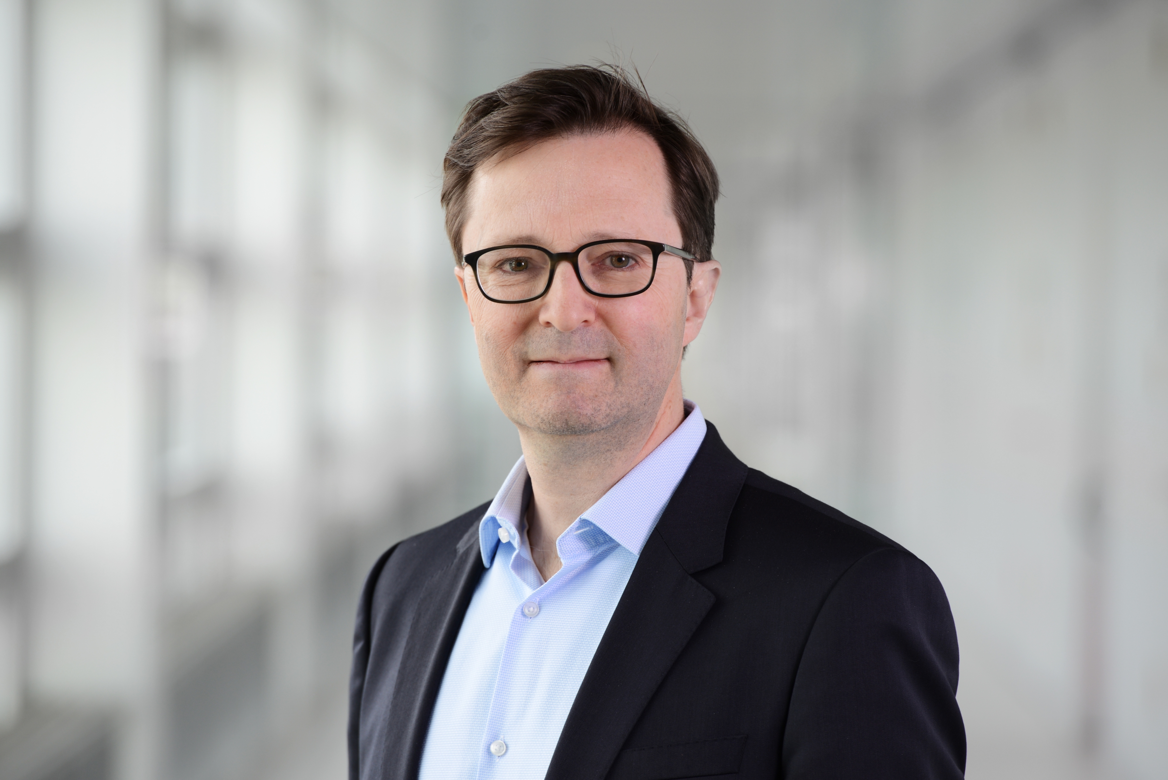
Andreas Wieser
Andreas Wieser is engaged in the development of innovative measurement systems and analysis methods for highly accurate positioning, navigation, and continuous geodetic monitoring of buildings and natural objects. He is particularly interested in parameter estimation, rigorous quality control and simulation based optimisation of measurement processes. Since 2012 he is Professor of Geosensorics and Engineering Geodesy at the Institute of Geodesy and Photogrammetry, in the Department of Civil, Environmental and Geomatics Engineering.
In 1995, Andreas Wieser graduated in Surveying from the Vienna University of Technology. He was then a doctoral student at TU Graz and obtained a PhD there in 2001 with a thesis on “Robust and fuzzy techniques for parameter estimation and quality assessment in GPS”. From 2003 to 2004 he was a postdoctoral researcher at the University of Calgary, Canada. He then worked as a teaching and research assistant at the Institute of Engineering Geodesy and Measurement Systems at the TU Graz, Austria, where his habilitation thesis on “GPS based velocity estimation and its application to an odometer” was accepted in 2007.
After a short period as Product Manager Electronic Tolling at Efkon AG, Graz, he became Professor of Engineering Geodesy at the Vienna University of Technology in 2009.
AdvanceAEC – Join this and further AdvanceAEC Partner Seminars and receive an AdvanceAEC certificate!
This lecture is part of the AdvanceAEC Partner Seminar series. There will be eight Partner Seminars in 2023. Partner Seminars focus on cross-sectional and interdisciplinary topics and are open to all network partners. If you attend at least six of the eight seminars, you will receive a certificate of time attendance. You will need to register for this at the beginning of each event. The procedure for this will be briefly explained before each seminar.
The access data for this event is available to AdvanceAEC members. All researchers working in the field of AdvanceAEC are welcome to join the network. Please register or log in to access the event credentials.